Projects.
Here are some projects and works in progress.
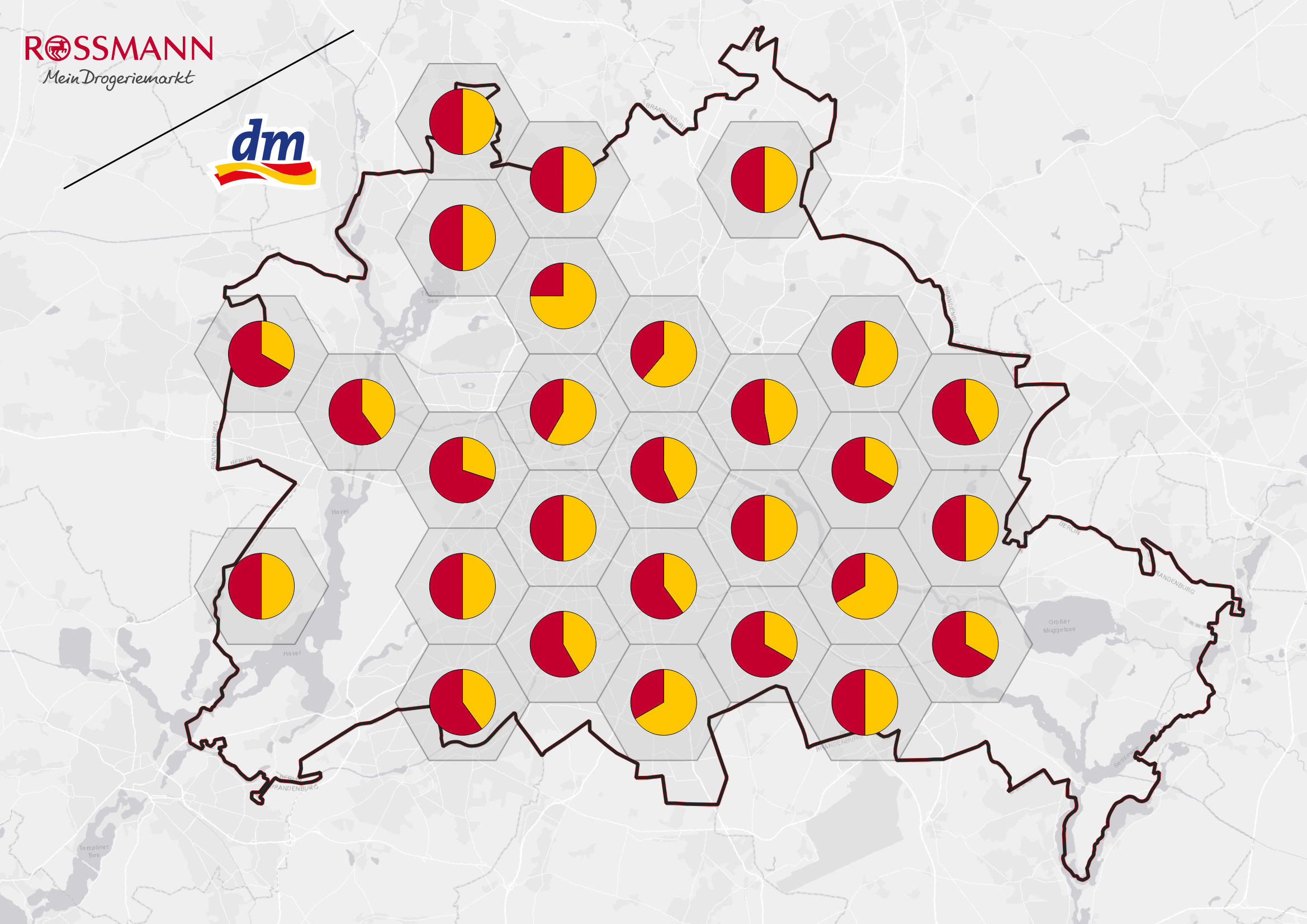
Retail Drugstore Market Analysis.
A data-driven analysis to demonstrate a duopoly using geospatial tools.

Landcover Zonal Statistics.
An automated script to assess Landcover by region using the CORINE Landcover dataset.

Trilateration Using Leaflet & Turf JS.
A JavaScript implementation of how trilateration works to determine user location.

MVG Dashboard.
A dashboard that shows upcoming departures for a given station from Munich's Public Transport API.

3D Space Time Cube.
This tool allows to visualize a 3D space time cube from a single GPX file.

DEM Raster to 3D Plot.
This tool plots a given digital elevation model (DEM) raster image with elevation values on an X,Y,Z 3D Matplotlib plot.

DRentMap.
A Web application that maps the rent in Münster, Germany using HTML Scraping and Leaflet.

Drone Imagery Web Application.
A WebApp and Server built using Angular JS with UI Components built using Angular Material.

Dynamic RSS-based HTML Scraper.
A Python HTML-Scraper that scrapes TheMarker.com RSS feed.

WMSGetFeatureInfo Using LeafletJS.
A short tutorial to implementing a custom WMSGetFeatureInfo function using LeafletJS