Trilateration Using Leaflet JS.
A JavaScript implementation of how trilateration works to determine user location.
Technologies Used: HTML, JavaScript (Leaflet, Turf JS)
Description
This map showcases the fundamental concept of trilateration by allowing users to simulate locating a point using three known reference points. Through this map-based interface, users draw three circles, each representing a known distance from a specific point. Trilateration , a geometric technique utilized in GPS systems, estimates an unknown location by intersecting these circles. A figure to illustrate in 2D:
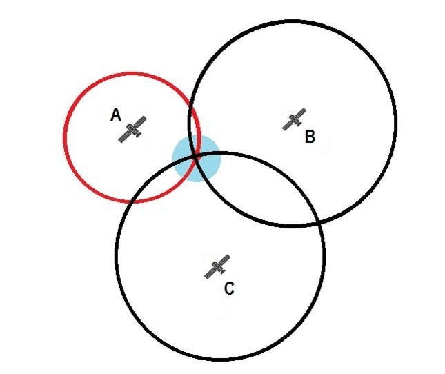
As the circles intersect, the map dynamically computes and displays the potential location of the unknown point. By interacting with the map and observing how the intersection of these circles narrows down the possible locations, it's possible to see how this essential location-finding method works.
Instructions
This map allows trilaterating three circles that intersect to show the approximate user location. Follow these steps:
- Draw 3 circles that demonstrate the known locations, with the radius displayed being the known distance
- Click
Find My Locationto obtain the user location - View results below